StormTracker8: Spring-like weekend; VIPIR alert for severe storms Monday
 VENN
VENN
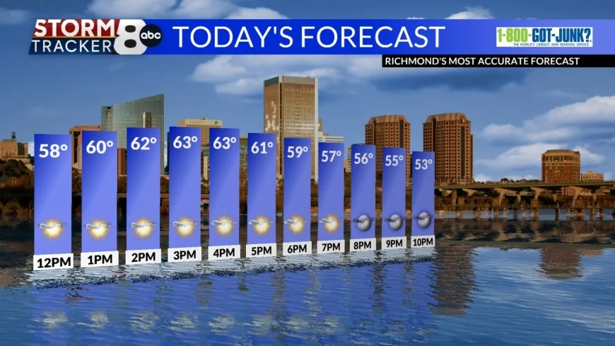
Richmond, Va (WRIC) -- Today is going to be a great day across Central Virginia with mostly sunny skies and highs in the low to mid 60s.

Sunday will start off with some sun, but clouds will increase throughout the day giving us cloudy skies by the evening. Temperatures will be mild with highs in the upper 60s.
Showers will move in late Sunday night to early Monday with lows in the upper 50s.

Monday, a VIPIR alert is in place as a strong cold front will be making its way across the region during the afternoon hours and bring us the risk of strong to severe storms. Ahead of this front our temperatures will be in the low 70s and there will be considerable moisture. This will help to develop strong to severe thunderstorms across Central Virginia.

Behind the cold front will be clearing skies a significant cool off bringing our overnight lows into the upper 20s and low 30s for Monday night. Highs on Tuesday will be chilly in the mid 40s and mostly sunny skies will be with us.
Wednesday, a few more clouds will be with us giving us partly sunny conditions. Temperatures will still be cool in the upper 40s to low 50s.
Thursday is when seasonable conditions return and highs will be in the upper 50s under mostly sunny skies.
Friday is the first day of Spring and the season will officially begin at 10:46am. It will be a perfect spring day with temperatures in the mid 60s under partly sunny skies.
Similar conditions will be with us for next Saturday as we begin the weekend.


