StormTracker 8: Cloudy & cool today with a few isolated showers
 VENN
VENN
RICHMOND, Va. (WRIC) - Unsettled weather continues the next few days before finally some dry weather returns for the first day of summer. We are also finally looking fry for the weekend ahead.
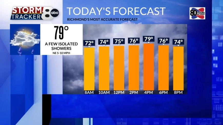
A few lingering isolated showers possible this morning and there is some patchy fog around. Today we will see mostly cloudy to partly cloudy skies and high temperatures near 80°. It will be cooler to our north (middle to upper 70s) and warmer south (low to middle 80s). A few more isolated showers and storms are possible late this afternoon and evening.


Overnight lows drop into the middle to upper 60s under mostly cloudy skies.
Tomorrow will be warmer with highs in the middle 80s with late day scattered showers and storms moving in.

Wednesday and Thursday look to be the hottest this week with highs in the low to middle 90s and triple digit heat indices. A few hit or miss showers/storms are possible on Wednesday with more late day scattered storms moving in for Thursday.
Friday starts summer at 10:42PM and we will see partly sunny skies. Look for highs in the upper 80s.

Right now it looks like it will be a dry weekend, finally! Mostly sunny skies and hot conditions will be with us for the weekend and into Monday of next week.


