StormTracker8: Showers and Storms Possible through Midnight; Dry & Cool Tomorrow
 VENN
VENN
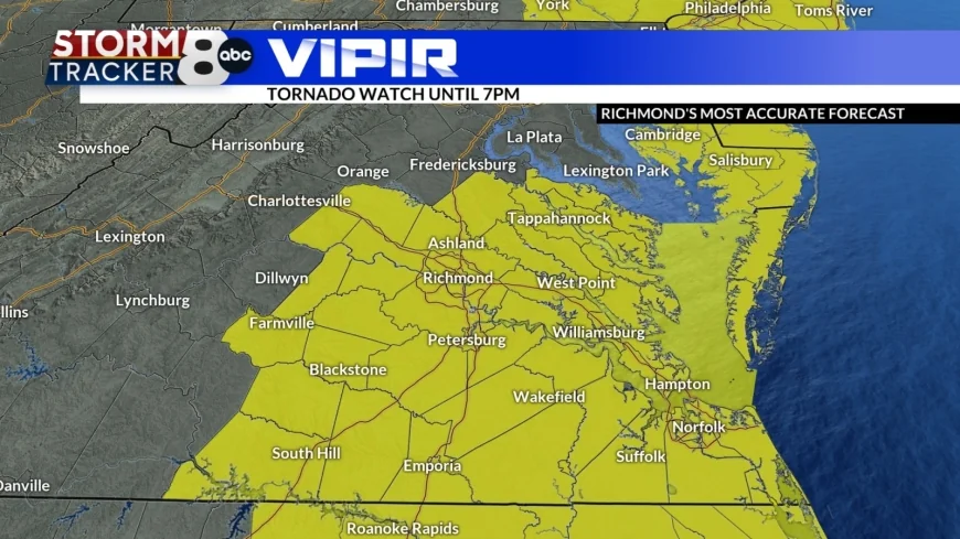
Richmond, Va (WRIC) -- A tornado watch is in place until 7:00pm across eastern portions of the state, but the threat for severe weather has dropped so drastically that we have cancelled the VIPIR alert for today. The best place to see severe weather will be in SE Virginia.

With dewpoints plummeting, the air is becoming more and more stable. Even as the next round of showers and thunderstorms pulls through the region between 6 and 9pm, severe weather is unlikely. Winds could still gust near 50mph as the front pushes through.

The next two days will be cooler, but dry! Be sure to bundle up tonight, as lows drop back into the 30s. Highs for Tuesday and Wednesday will be in the upper 40s.


The Spring season officially begins on Friday at 10:46am and temperatures will be comfortable in the mid 60s under mostly sunny skies.

The weekend is looking nice with partly sunny skies and highs in the upper 60s on Saturday and slightly cooling into the low 60s for Sunday. As we finish off our weekend we could see a few passing showers.


