StormTracker8: Snowstorm looking likely this weekend
 VENN
VENN
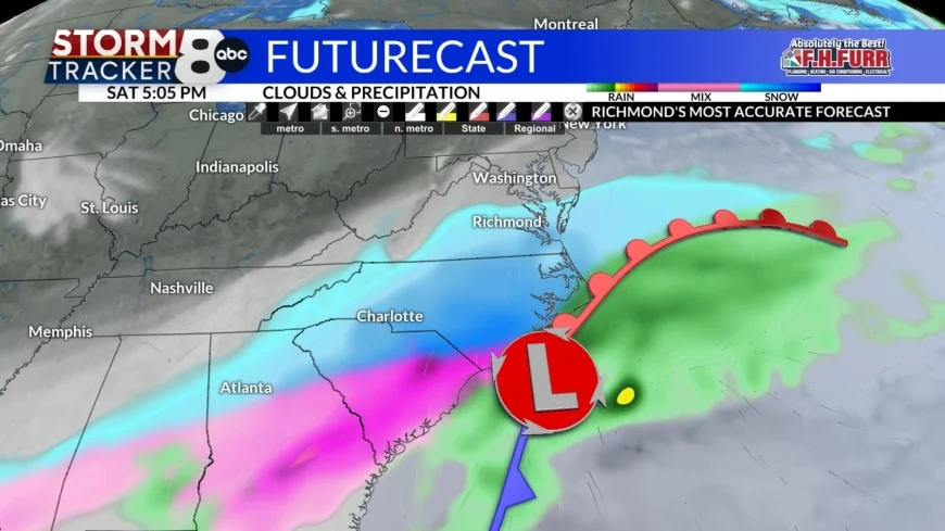
Richmond, Va. (WRIC) -- There are significant signs in many of our long-range weather models that a snowstorm will move into Central Virginia on Saturday and move out during Sunday. Specific details still need to be worked out, and we will continue to fine tune that part of the forecast over the next several days.

In the short-term, clear skies will be with us tonight and it will be a very cold night with lows in the middle to upper teens.

Tuesday will be a sunny day, but it will remain cold as Arctic air stays in place over Central Virginia. Our high temperatures will top out in the middle 30s.
Wednesday will feature mostly sunny skies, and it will be a chilly day with highs in the lower 40s.
Partly sunny skies will be with us for Thursday as another arctic front crossing the region during the afternoon. Ahead of that front we should climb into the lower to middle 50s but behind that front get ready for some colder temperatures which could set up the weekend snowstorm.
Friday will be a partly sunny day with highs in the upper 30s to lower 40s.

While our weather will be quiet on Friday all eyes will be watching Central and Eastern Texas for the development of our next weather system which will be our weekend snowstorm. At this point the exact track of the storm is not clearly defined, however there is considerable model agreement that Central Virginia will see snow developing Saturday and that will last into Sunday. Right now, this seems to be one of the better snowstorms in quite some time but because the exact track cannot be determined, it is still way too early to talk about accumulations for Central Virginia. It looks like the snow should begin by early afternoon Saturday and exit early Sunday morning. Our high temperatures on Saturday and Sunday will be in the lower to middle twenties.
Sunny skies will return for Monday and Tuesday with highs in the middle 20s on Monday and around 30 for Tuesday.


