StormTracker8: Spring weather this weekend; VIPIR Alert for severe storms Monday
 VENN
VENN
RICHMOND, Va. (WRIC) -- Mainly clear skies to be with us for this evening and tonight and it will be a chilly night with lows around 40.

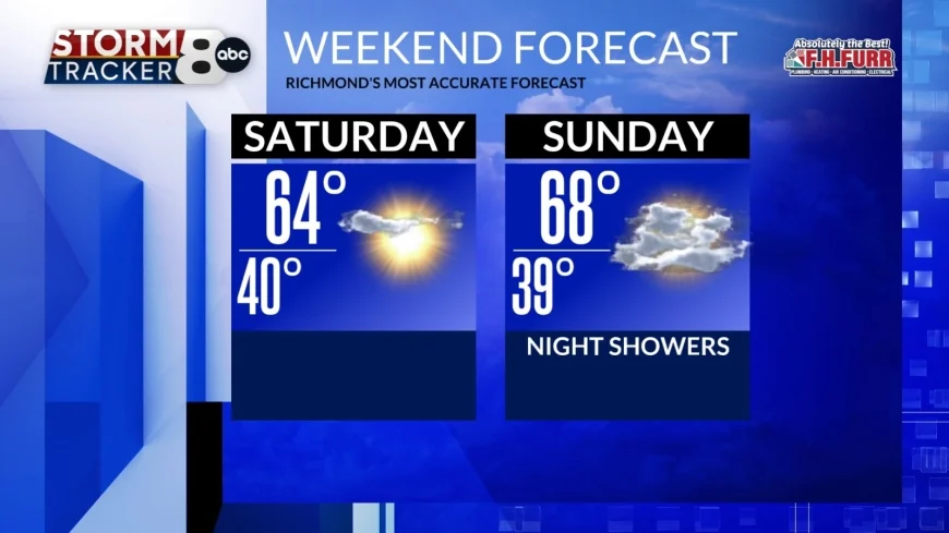
Saturday will be a delightful day with mostly sunny skies and highs near 65.


Sunday will start off with Sunshine however clouds will increase during the afternoon and by the evening it will be cloudy. It will be very mild with highs in the upper 60s.
Showers will move in Sunday night to early Monday with lows in the upper 50s.

Monday will be a Viper alert day as a powerful cold front will push into Central Virginia during the afternoon bringing us the risk of strong to severe storms. Out ahead of this front our temperatures will climb into the lower 70s and there will be considerable moisture around to help develop strong to severe thunderstorms across central Virginia. When we're talking about strong to severe thunderstorms, we are including storms that could produce damaging winds in excess of 58 mph, possibly hail 1 inch in diameter or larger and the possibility of tornadoes developing with this storm.
Behind that front we will cool off significantly and our skies will clear by Tuesday morning with our overnight lows in the upper 20s and lower 30s.
Mostly sunny skies will be with us for Tuesday with highs in the middle 40s.
Wednesday will also feature mostly sunny skies, and it will remain a touch chilly with highs in the upper 40s to near 50.
By Thursday we will return to normal with highs in the upper 50s under partly sunny skies.
Friday is the first day of spring as it officially begins at 10:46 in the morning and it will be a perfect day for the first day of spring with highs in the middle 60s under partly sunny skies.
Looking ahead to next Saturday we should see mostly sunny skies with highs in the upper 60s to near 70.


