StormTracker 8: A warmer weekend ahead
 VENN
VENN
RICHMOND, Va. (WRIC) - It will be a warmer weekend for us with above average temperatures expected once again. The warmer temperatures will only stick around for the weekend as temperatures will drop for the work week.


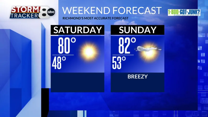
Sunshine will be with us throughout the day today and highs will be near 80. Clear skies continue tonight, and overnight lows drop to near 50.
Sunny skies continue tomorrow, and it will be a touch warmer with highs in the low 80s. A few high clouds will move in for the later half of the day ahead of our next front and it will be breezy at times with winds gusting up to 25mph.

Sunday night into Monday a front will move in which will drop our temperatures down for the work week. Overnight a few isolated rain showers are possible, but this is a mostly dry boundary.
Monday is Columbus Day and temperatures will be back to near seasonable with highs in the lower 70s under partly cloudy skies. We will stay breezy on Monday with winds gusting up to 30mph at times.

Tuesday will be even cooler with highs in the lower 60s. Overnight lows will also be chilly with temperatures dropping to near 40 which means many outlying areas will drop into the 30s. Frost is possible for some especially west of I-95.
By the end of the week temperatures will gradually warm with highs back to near 70 by Friday. We stay dry for the entire week with no significant rain maker on the way.


