StormTracker 8: Snow on the way for Friday night

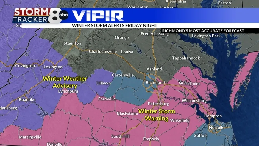
RICHMOND, Va. (WRIC) -VIPIR Alert for the next storm system that is on the way to the area for tomorrow night into Saturday morning. Most of the southern part of the state and parts of the metro area are under a Winter Storm Warning for tomorrow night until midday Saturday.

Skies will be clear tonight with lows in the mid teens.

Clouds increase on Friday with highs in the middle 30s.
Snow will be on the doorstep by the dinner hour tomorrow night. This snow will be an overnight event for the area with snow falling from around 10pm to 6am. Look at the progression of maps to see how it goes.


By Saturday afternoon we will see a return of some sunshine in the area with highs in the mid to upper 30s.
OK, over the Metro Richmond area, the warnings are “split” right now. There is a question of just how far north the “heavy” (4” or more) snow will make it. So the warning is in effect EAST of US-360, while for right now a watch is in effect west of that—an NOT in Hanover.


Over the area we can expect 2”-4” with a few 5” spots in the warning and the western parts of the metro area. 2”-3” down to the south with a little mixing, and areas to our north decrease to just about nothing by Fredericksburg.

Sunday is sunny and in the upper 30s. Most of next week is seasonably cold over the area.
Long range models continue to show a storm risk for next weekend, but the timing varies all over the place right now.

 VENN
VENN 


