StormTracker8: Cool Start to the Week
 VENN
VENN
Richmond, Va. (WRIC) -- The snow and rain has ended, and most of us are left with slick roads and puddles. The further northeast you travel, the more likely you are to see snow still on the ground from last night. Folks from the Northern Neck and Middle Peninsula saw a few inches, so travel could be more dangerous in that region.
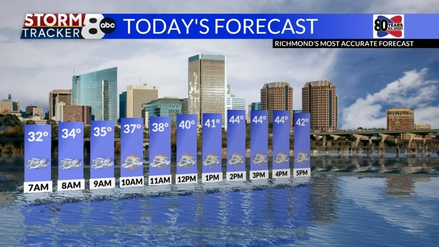
Today will be cloudy and cool. Highs will stay in the low to mid 40s.

It will also be windy, with gusts near 25mph, so it will feel even chillier this afternoon than the air temperatures are.

Tonight, skies will clear and we will have the coldest morning we have seen in awhile, in the mid 20s. Leftover water on roadways could freeze tonight and give us some areas of black ice, but roads are not expected to be a major concern.
Tomorrow will be much sunnier and highs will be in the low 40s.

Wednesday will be cloudy but warm, with highs in the 50s. A stray shower is possible, but our next real rain chances are on Thursday. Temperatures will be well above freezing. The rain will linger into early Friday morning, and then skies will clear on Friday afternoon.

This weekend is looking much nicer than the last two, with dry conditions and highs near 60°. The first week of March is projected to be slightly above normal in terms of temperatures.


