StormTracker8: Mild & cloudier Sunday; ‘Winter’ returns Monday
 VENN
VENN
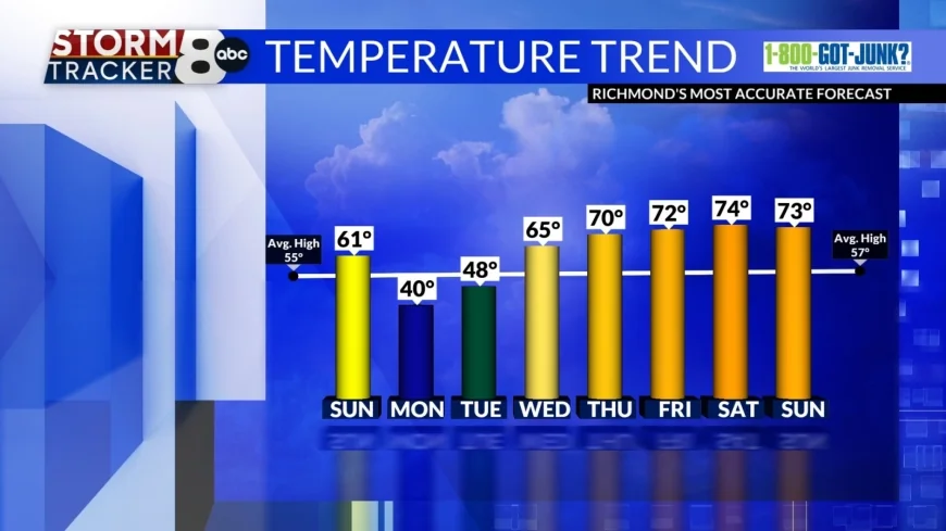
Richmond, Va (WRIC) -- We'll have another mild day to end our weekend and kick of Meteorological Spring with highs in the low 60s under partly cloudy skies.

Temperatures for when we wake up on Monday will be chilly near 30.

Highs on Monday will be cool near 40 and a wintry mix of precipitation will start during the afternoon hours. This mix will include rain and wet snow and will continue into Tuesday where the mix will then transition into rain before lunch. Temperatures on Tuesday will remain cool in the upper 40s.
We will see mild enough conditions leading up to the precipitation that we will not see major impacts or accumulations.

By mid-week temperatures will improve and be much more seasonable, but spotty to isolated rain chances persist from Wednesday to Sunday.
Wednesday highs will be in the mid 60s.

Central Virginia will get even more of a warm up on Thursday when we are expected to reach 70 for the first time this year. A similar temperature trend is expected as we finish off our work week and through next weekend. This is what we've been waiting for!


