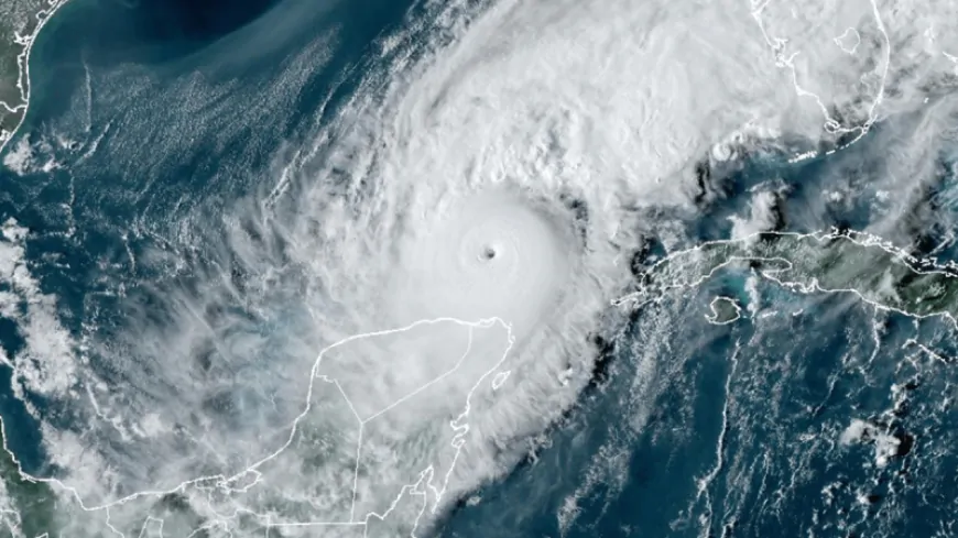
Wobble Tracker: Live updates on Hurricane Milton’s path across Florida

....................
TAMPA, Fla. (WFLA) — Hurricane Milton, which fluctuated between a Category 4 and Category 5 hurricane on its approach to Florida's west coast, slowed to a Category 3 before hitting land south of Tampa Wednesday evening.
Winds above 100 mph knocked out power for thousands, and the toll of flooding and floating debris won't be known until well after sunrise.
As of late Wednesday, the storm continued to work its way across central Florida. The Wobble Tracker — a tool used by Nexstar's WFLA to track “wobbles,” or small movements on the system’s path — shows just where the storm has been and where it is projected to go. The map tracks slight movements, or wobbles, in the course that could mean a devastating change of fate for communities near the path.
Tracking the Tropics: Stay updated on Milton with WFLA's live coverage
Milton is just the latest system in a storm season that scientists say is the weirdest they have ever seen.
Beryl became the earliest storm on record to reach Category 5 status, but there was record quiet from Aug. 20 — the traditional start of peak hurricane season — to Sept. 23, according to Colorado State University hurricane researcher Phil Klotzbach.
Then five hurricanes popped up between Sept. 26 and Oct. 6, which is more than double the old record of two. On Sunday and Monday, there were three hurricanes at the same time, which had never happened before, Klotzback said.
In just 46 1/2 hours, Milton went from forming as a tropical storm with 40 mph winds to a top-of-the-charts Category 5 hurricane. The storm is projected to be further downgraded before it reaches the Atlantic Ocean.
The Associated Press contributed to this report.
Be prepared with the 2024 Hurricane Guide and stay ahead of tropical development with WFLA's Tracking the Tropics newsletter.

 VENN
VENN 


