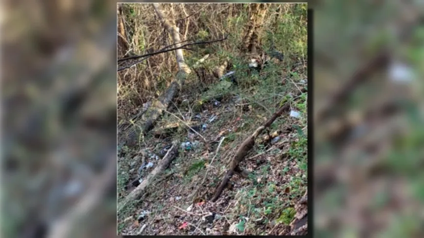
National Park Service asks for public comment on plans for Chesterfield landfill

CHESTERFIELD COUNTY, Va. (WRIC) -- The National Park Service is asking for the public's opinion on several possible solutions to prevent the exposure of potentially hazardous waste from a landfill site at the Richmond National Battlefield Park in Chesterfield.
The National Park Service has recently opened a comment period for the public to provide feedback on its Engineering Evaluation/Cost Analysis (EE/CA) Report Addendum, which identifies and evaluates four removal action alternatives for the Fort Darling Landfill Site's north slope area.
According to the National Park Service, the alternatives were identified to address the results of updated human health and ecological risk assessments and the historical presence of hazardous waste at the site.
Those who wish to comment on the addendum can do so until midnight on Nov. 30 by visiting the National Park Service's website.
Background on the Fort Darling Landfill Site
The Fort Darling Landfill Site is located in the Drewry's Bluff Unit of the Richmond National Battlefield Park in Chesterfield County on metropolitan Richmond's Southside, between the western bank of the James River and Interstate 95.
According to the National Park Service, Chesterfield County obtained ownership of several parcels of land surrounding Fort Darling between 1960 and 1969 and operated a 10-acre municipal landfill on the 23-acre parcel to the south of Fort Darling from 1963 to 1972.
The landfill and surrounding property were then donated to the federal government by Chesterfield County in 1975 and is now managed by the National Park Service.

A map of the Fort Darling Landfill Site (Photo courtesy of the National Park Service)
Environmental investigations into the landfill
According to the National Park Service, multiple environmental investigations related to the landfill site have been conducted since 1985.
In 2008, the National Park Service initiated an EE/CA investigation to determine the nature and extent of contamination at the site, which included drilling and installing groundwater monitoring wells, testing for the presence of landfill gas, as well as sampling groundwater, surface water and soil.
The EE/CA also included a human health risk assessment and a screening-level ecological risk assessment, according to officials.
The investigation's results were documented in a 2015 report which identified methane and volatile organic compounds (VOCs) in the groundwater, as well as unconsolidated landfill waste materials present on the landfill's north slope, according to the addendum.
According to the National Park Service, following the 2015 report, the recommended removal actions for the site included:
- Land-use restrictions and pre-construction sampling to address the methane identified in the groundwater
- Monitored natural attenuation and institutional controls to address VOCs in the groundwater
- Periodic removal of potentially hazardous landfill waste to address unconsolidated materials that are or will become exposed over time due to erosion on the landfill north slope
Ongoing problems with the landfill's north slope
In the 2015 report, a minor slope failure was reported to have occurred on the northern landfill slope related to the unconsolidated landfill waste area of concern, however, established trees in the area appeared to effectively stabilize the slope, according to the addendum.
Prior to the final selection of a removal alternative, National Park Service staff noted that the north slope was in a state of failure during visits to the site in 2017 and 2018, according to officials.

A section of the landfill's north slope with visible waste in December 2020. (Photo courtesy of the National Park Service)
According to the National Park Service, the slope failure caused large areas of previously buried unconsolidated waste to be exposed, including drums that may contain hazardous waste.
An additional investigation was completed in 2018 to identify the extent of hazardous substances released from the landfill's north slope and whether exposures to such releases pose a risk to people or other organisms.
According to the National Park Service, in addition to exposing people and organisms to contaminated soil and landfill waste, a more dramatic failure of the slope could significantly impact a nearby, unnamed stream.
The National Park Service said with increased frequency and intensity of extreme weather events, there is a potential for slope failure processes to accelerate.
According to officials, updated human health and ecological risk assessments also identified unacceptable long-term human health exposure risks for park staff and construction workers involved in excavation activities.
About the addendum and public comment period
According to the National Park Service, the EE/CA Report Addendum identifies and evaluates four removal action alternatives for the landfill north slope area of the site ranging from no action to complete removal of landfill waste and contaminated soil.
The recommended alternative also includes modifying the steep north slope to a more stable angle, covering the exposed waste with two feet of clean soil and re-establishing the native forest.
The public is invited to review several documents listed on the National Park Service's website about the landfill and provide comments on the EE/CA Addendum by midnight on Nov. 30.
Once the public comments are reviewed, the National Park Service will release an Action Memorandum to document the selection of a final remedy.
To view the EE/CA Report Addendum and make a comment, visit the National Park Service's website.

 VENN
VENN 


