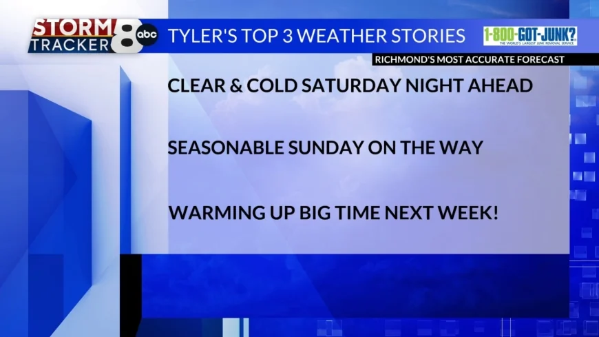
StormTracker8: Clear & cold Saturday night ahead; seasonable Sunday on the way
 VENN
VENN
RICHMOND, Va. (WRIC) -- After our chilly Saturday across Central Virginia today, we are in for a cold Saturday night ahead, but thankfully a nice warming trend is on the way heading into next work week, details below!
Tonight’s forecast for this Saturday night across Central Virginia, thanks to high pressure in the region for now, under clear skies, and calmer winds, we will see cold overnight temperatures dipping down into the upper 20s to the lower 30s.
Tomorrow’s forecast for our Sunday across the 8 News viewing area, calls for mostly sunny skies, light southerly winds and seasonable temperatures, rising to 60 to 65 degrees.
Monday will be fantastic, under partly sunny skies, and highs in the middle 70s.
Tuesday will be warm, under partly sunny skies, and highs 80 to 85 degrees.
Wednesday is when we will see our next weather system approach Central Virginia from our west and bring us afternoon and evening showers and thunderstorms to the area, under mostly cloudy skies and very warm temperatures, with highs near 85 degrees.
That weather system expected for Wednesday of next work week, will stall out across the Mid Atlantic Region, for days late next work week, bringing multiple rounds of showers to the region next Thursday, next Friday, and next Saturday.
Aside from the rain threat for Wednesday through Saturday of next week, it will be well above average for overnight and afternoon temperatures.
Finally, next Sunday, which is Easter Sunday, is looking decent right now, under mostly cloudy skies, warm temperatures rising to around 80 degrees and night showers developing by next Sunday night.


